Jay and Troy both border Canada to the north. Just south of Jay, settlement in Westfield (altitude, 825 ft.) clusters along Route 100 and is centered on an unincorporated area called Westfield.
This cluster lies just 1.6 miles from a second unincorporated area called Troy, to the northeast on route 100. The population cluster in Troy is further defined by the county road 101, running due north through the incorporated cluster, to the village of North Troy some 6 and 1/2 miles and just south of the Canadian border. Like Westfield town, Jay town has much of its population on its eastern flank. Jay's population is also centered along route 242 running from Jay to Montgomery Center (in Montgomery Town) to the immediate west. Jay and Westfield town shapes are approximate squares.
Location and defining features of Jay, Vermont
In terms of “defining features,” we recognize, of course, that a site visit will challenge and augment many of the observations in this profile. However, one could describe Jay as dominated by Jay Peak. It is visible from many view corridors all over the region (see more detail in Natural Resources below). One important local feature of Troy might well be the cluster of civic buildings so integral to life in North Troy Village. In Westfield, it might be the small but noteworthy town green, another historic and modern locale where townspeople meet.
Jay was chartered on November 7, 1792 and again on December 28, 1792. The story behind Jay's other, previous names, Wyllis and Carthage, captures a bit of the history of the period. As a town, Jay is unique in holding two charters; the first, covering 7,600 acres in the southern section was issued to Governor Thomas Chittenden in lieu of several hundred pounds the state owed him for back salary. The December charter covered 15,360 acres to the north and was given to John Jay (the great New York statesman) and a colleague in appreciation for Jay's assistance in settling the land dispute with New York and thereby opening the door to Vermont's becoming the fourteenth state in the Union.
The Wyllis family, had petitioned Vermont for a northern land grant. The petition was honored by the legislature in March of 1780 for a town to be called Wyllis. This grant was forfeited in 1782 for reasons unknown, although Swift suggests we might assume the locale was a bit too northerly and remote.
In October, 1783 the legislature, pressed to meet a debt to Governor Chittenden of 350 pounds, voted that it be paid by issuing one half of the forfeited rights in the town of Carthage to the Governor. Of unknown origins, this was the first reference to the Carthage place name. Still short on money, the legislature decided to pay Surveyor General Ira Allen's salary with land, telling him he could sell the rest of the forfeited rights in Carthage.
Having no luck in selling the land, Allen basically returned the land to the state, negotiating title to a piece located elsewhere. Allen and Chittenden's political opponents turned these (and presumably other land dealings) into campaign issues and Chittenden was defeated in the 1789 election. In 1792, despite the acknowledgement that the Chittenden had done nothing wrong, legislators had moved on to address new and different challenges and eager to acknowledge Jay's statesmanship fixed the area's name at Jay.
The town was slow to be settled. No population is recorded in either the census of 1791 or 1800, and a post office doesn't emerge until 1836, closing in 1905. The post office was referred to as “Jay,” indicating the longevity of a cluster in the immediate area of the unincorporated village. Today (at least through the late 1970s) most of the townspeople receive mail services from the office in North Troy (Swift, 1977, p. 362-3).
Northeast Kingdom Natural Resources
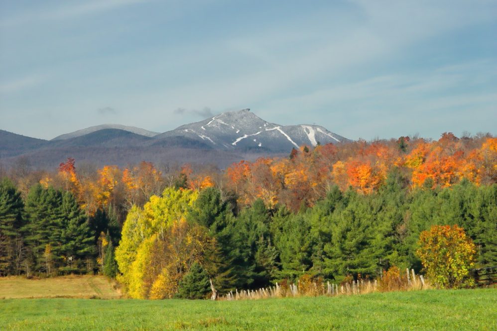
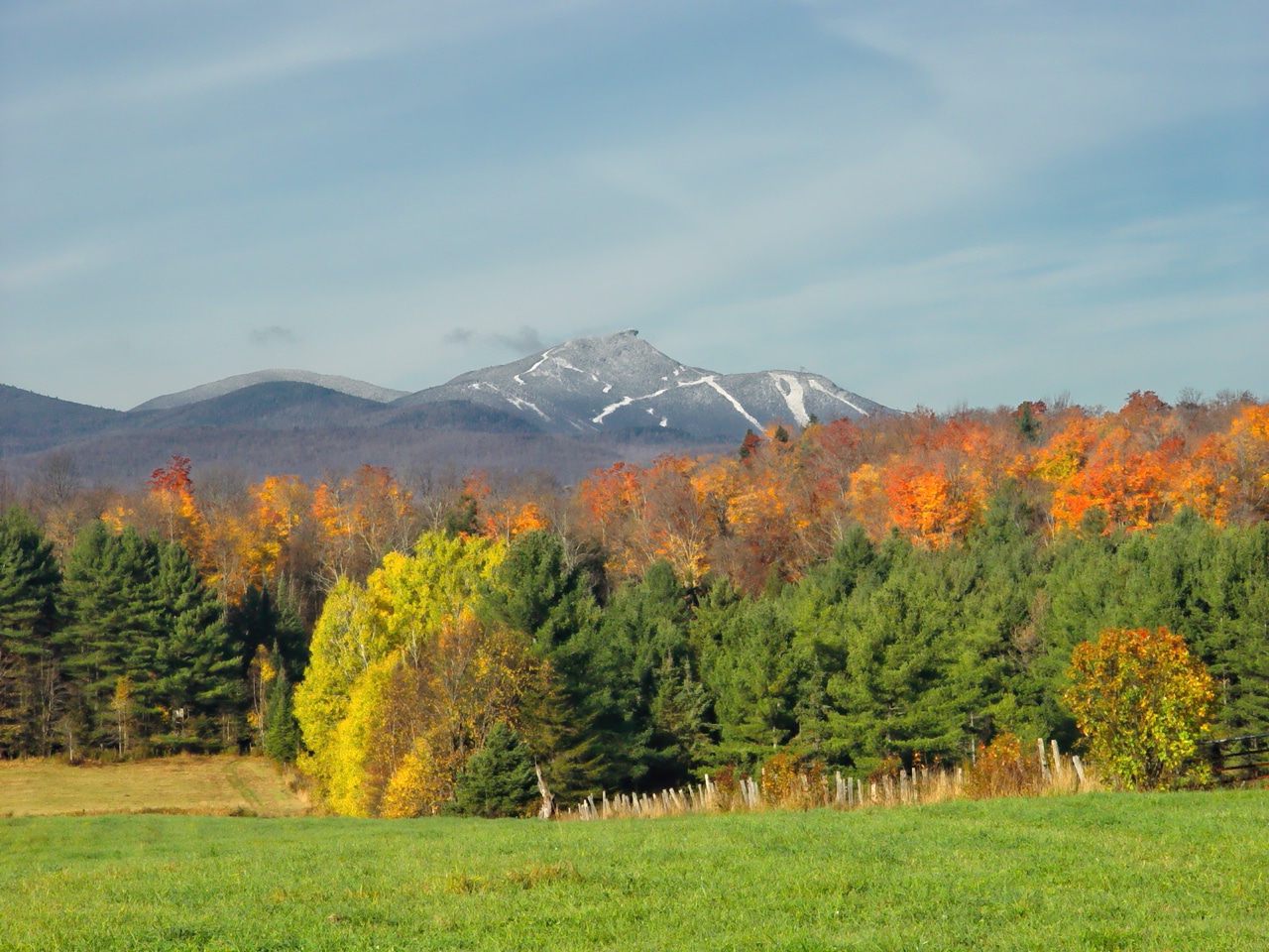
Obviously, these towns are heavily influenced by the natural resource base. Farm and forest land dominate in all three. Jay and Westfield share a series of peaks defining the northern most chain of the Green Mountains. The peaks immediately related to Jay Peak form a critical part of the local, regional, and even, one might suggest, the international landscape.
These peaks dominate the area and are visible from all three towns and many points throughout the Northeast Kingdom, including being part of a panoramic landscape visible from Burke Mountain, from the fire tower near Lake Elmore, from the town lookout in Brownington, as well as many areas to the west and from vantage points along the broad alluvial river plain formed by the St. Lawrence River in Canada. It is reported “on a clear day, one may view the streets of Montreal to the northwest, the White Mountains to the east, and Lake Champlain and the Adirondacks to the south and west.”
Troy has no very high peaks. The only hill usually appearing on town maps is the 1,200 foot high Warner Hill on the western outskirts of North Troy village. On the other hand, with the exception of the Jay Peak Ski Area, Troy enjoys a historic built infrastructure, e. g. sites of old mills, civic buildings, the covered bridge, and so on. Jay Peak The spectacular northern spur of the Green Mountain chain runs from the southwestern most corner of Westfield, due north through western Jay to the Canadian border. It is further identified as the northern-most section of Vermont's famous Long Trail.
From the south to the north, the following named features emerge: Hazens Notch (altitude 1700 ft.) by Hazens Notch State Park and Natural Area, Sugarloaf Mountain (2543 ft.), Strawberry Hill (Long Trail State Forest), Buchanan Mountain (2,940 ft.), Domeys Dome (2,820 ft.), Gilpin Mountain (2,940 ft.), Little Jay (3,182), Big Jay (3,786 ft.), Jay Peak (3,861 ft.) and North Jay Peak (3,438 ft.).
Ironically, of all the “Jay” named peaks in this area, only North Jay Peak actually lies in Jay Town. Big and Little Jay lie 1/ 10 of a mile west of the Westfield Town's western border in Montgomery Town. Jay Peak, Jay State Forest and Jay Peak Trail all lie in Westfield Town. Of the three towns, we have found evidence of a talc quarry in Troy, owned by Vermont Talc (with mills in Chester and Johnson), and a second, older quarry in Windham.
While the mountains in the western portions of these towns provide often spectacular skylines, there are a number of significant local “viewscapes,” including those from Hazen's Notch, the state forests, the long trails and especially around the River Road Covered Bridge in Troy. Other infrastructure-enhancing local civic structures include the cluster of activity in North Troy Village, exemplified by the close proximity of the town fire station, the library, Troy Elementary School, the Town Hall and the Post Office. Moreover, the underutilized railroad and accompanying railroad bed is still an important resource to the village town and region.
Courtesy of the Center For Rural Studies
Thank you for visiting Vermonter.com! Please subscribe to our email list for the latest articles!